Home / Directory / List product / Detail Product

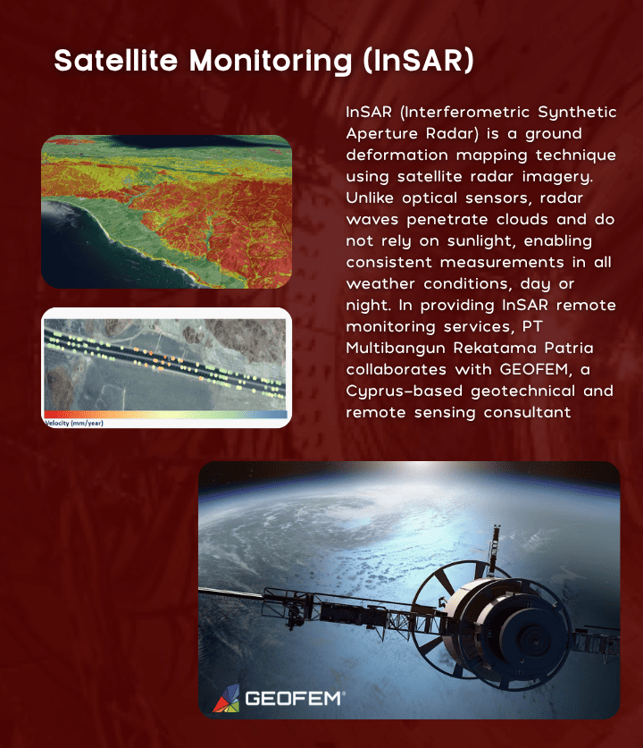
Satellite Monitoring (InSAR)

By :

Views

13 Views

Share With Friends

InSAR (Interferometric Synthetic Aperture Radar) is a ground deformation mapping technique using satellite radar imagery. Unlike optical sensors, radar waves penetrate clouds and do not rely on sunlight, enabling consistent measurements in all weather conditions, day or night. In providing InSAR remote monitoring services, PT Multibangun Rekatama Patria collaborates with GEOFEM, a Cyprus-based geotechnical and remote sensing consultant

Advertisement

Relate Product

Hello! We would like to talk to you.Please fill the details below to start chatting with us.